

I noticed theres a few flight simmers on here and I thought I'd share a some of the fun Im having with a Freeware program called Tileproxy. It's an excellent freeware program by a guy called christian buchner.
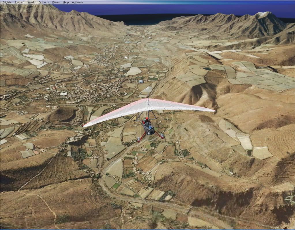
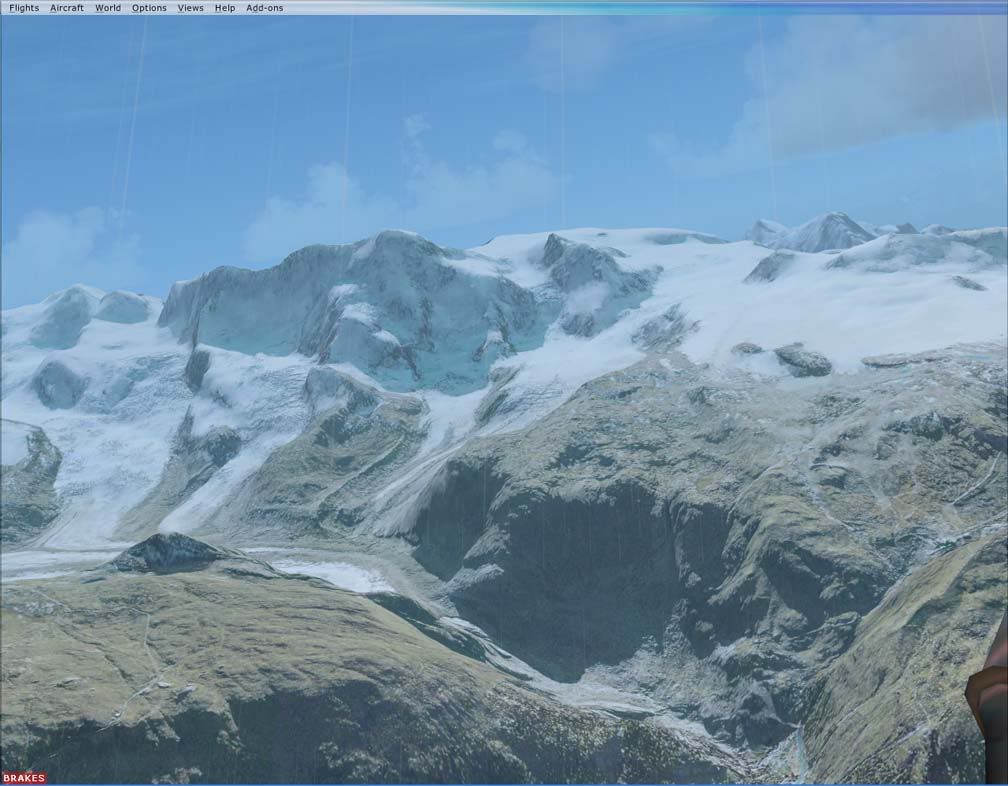
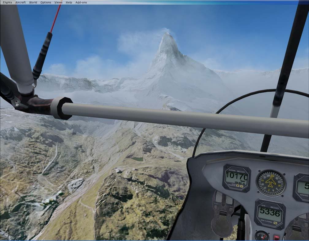
If you have a decent net connection you can use it to stream high quality terrain tiles from Google Earth, Virtual Earth, and Yahoo maps I think also, straight into and over the Terrain mesh in FSX. The results I've had are pretty stunning.
Theres a couple of downsides to it though as you can't really fly faster than 150 knots as the textures might not update fast enough which is a problem with FSX itself allegedly so it's really best suited to VFR flights.
You also lose Autogen which sounds bad at first but once once you're up in the air you dont miss it as the textures really create an excellent illusion of 3 dimensions. Plus you still get all the airport buildings and landmarks etc. and some of the textures can be different hues, but for summer daytime VFR it's gold.
Check out some of the Videos and screens I made and here's a link to the program. I suggest that you get some good terrain meshes if you're gonna spend a lot of time using Tileproxy as it really makes a huge difference.
Give it a go if you like VFR, Im having a great time with it. Have fun.
Download - http://sourceforge.net/projects/tileproxy
Support forum - http://forums.avsim.net/dcboard.php?...ge=show_topics
http://www.stage6.com/user/Bramski/video/1286983/Surfing-Saint-Helens
http://www.stage6.com/user/Bramski/video/1285461/Gran-Canaria-FSX-no-blur-at-high-speed
http://s175.photobucket.com/albums/w140/bramski/?action=view¤t=matterhorn.flv

 ).
).

")
 , but the results are very, very impressive, particularly outside of the US.

