Wow, that's some advance!
Maps posted four hours apart show scale and speed of Russian land losses
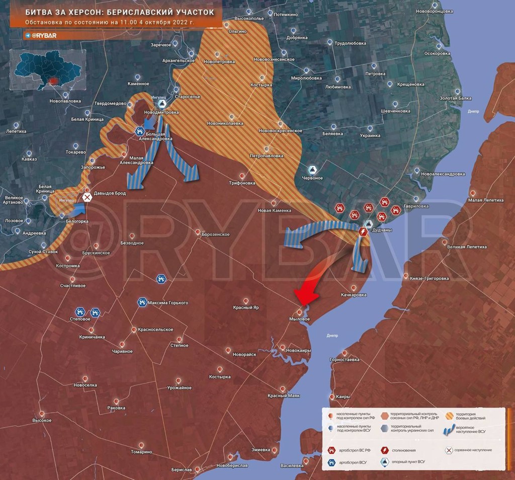
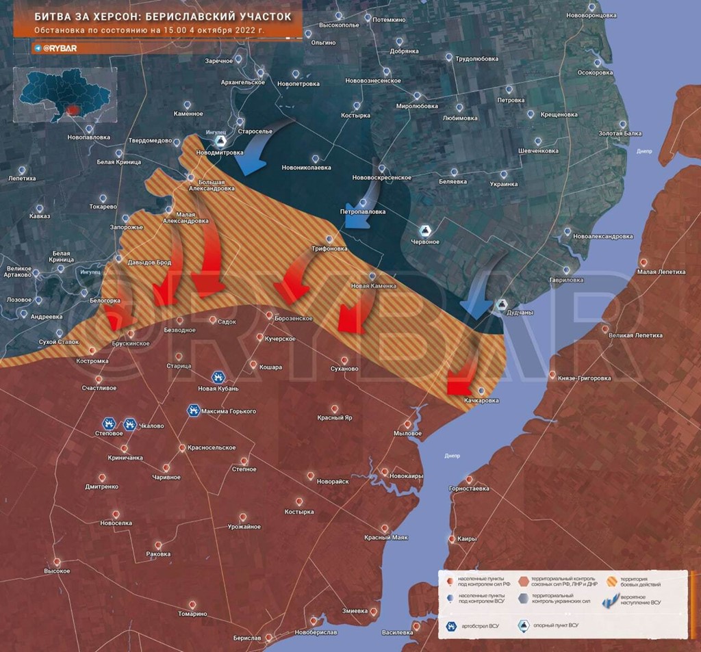
Rybar, one of the relatively few Russian sources of military information, has posted maps which show in stark detail the scale of Russian difficulties in the southern Kherson region.
We have seen images of Ukrainian troops planting yellow and blue flags in various villages as they push through the Russian defences - or in lots of cases, occupy areas after Vladimir Putin's troops have withdrawn.
This map was posted by Rybar at 11am this morning.
The key is in Russian, so for the avoidance of doubt, the blue area is controlled by Ukraine, while the reddish-brown area is held by Russia and its proxies in Donetsk and Luhansk.
The striped area is the current warzone.
You get an idea of how quickly the Ukrainians are regaining territory (and remember, this is land "annexed" by Russia last week) in the same, updated map posted just four hours later, with the striped warzone having expanded towards a clutch of settlements.
Rybar's post, according to a translation, makes bleak reading for Russia: "In the northeast of the Kherson region, the RF Armed Forces regrouped... a decision was made to withdraw the contingent of the RF Armed Forces to a new line of defence.
"However, the absence of any retaliatory actions and counteroffensives in the near future will create a threat of a further offensive of the Armed Forces of Ukraine on Berislav and Novaya Kakhovka, as well as Kherson from the Posad-Pokrovsky and Snigirevsky sectors. In addition, the control of the Armed Forces of Ukraine over the coast of the Dnieper River is an immediate danger to the Russian contingent on the left bank of the Dnieper.
"Ukrainian units, provided there is no opposition, will be able to carry out a landing operation using small boats, of which they have enough. And this is already a blow to the flank of the grouping of the RF Armed Forces in the Zaporozhye region and a direct exit to Melitopol."