

I use Waze every single day and it hasn't ever steered me wrong. With its social features, I often get re-routed when the M25 is heavy - It's great driving the country roads next to the motorway, and you can see the motorway isn't moving 
Not this again....Google own Waze.
Bing maps all day long, it has an OS explorer map layer, which you would normal have to pay several hundred £ for. Especially useful for the hikers, mountain bikers etc.
Here maps for sat nav, free and can download entire regions, unlike stupid google implementation.
Bing maps all day long, it has an OS explorer map layer, which you would normal have to pay several hundred £ for. Especially useful for the hikers, mountain bikers etc.
Here maps for sat nav, free and can download entire regions, unlike stupid google implementation.
") .
.When you type in "Bing Maps" into google play store it doesn't find it? Any ideas?
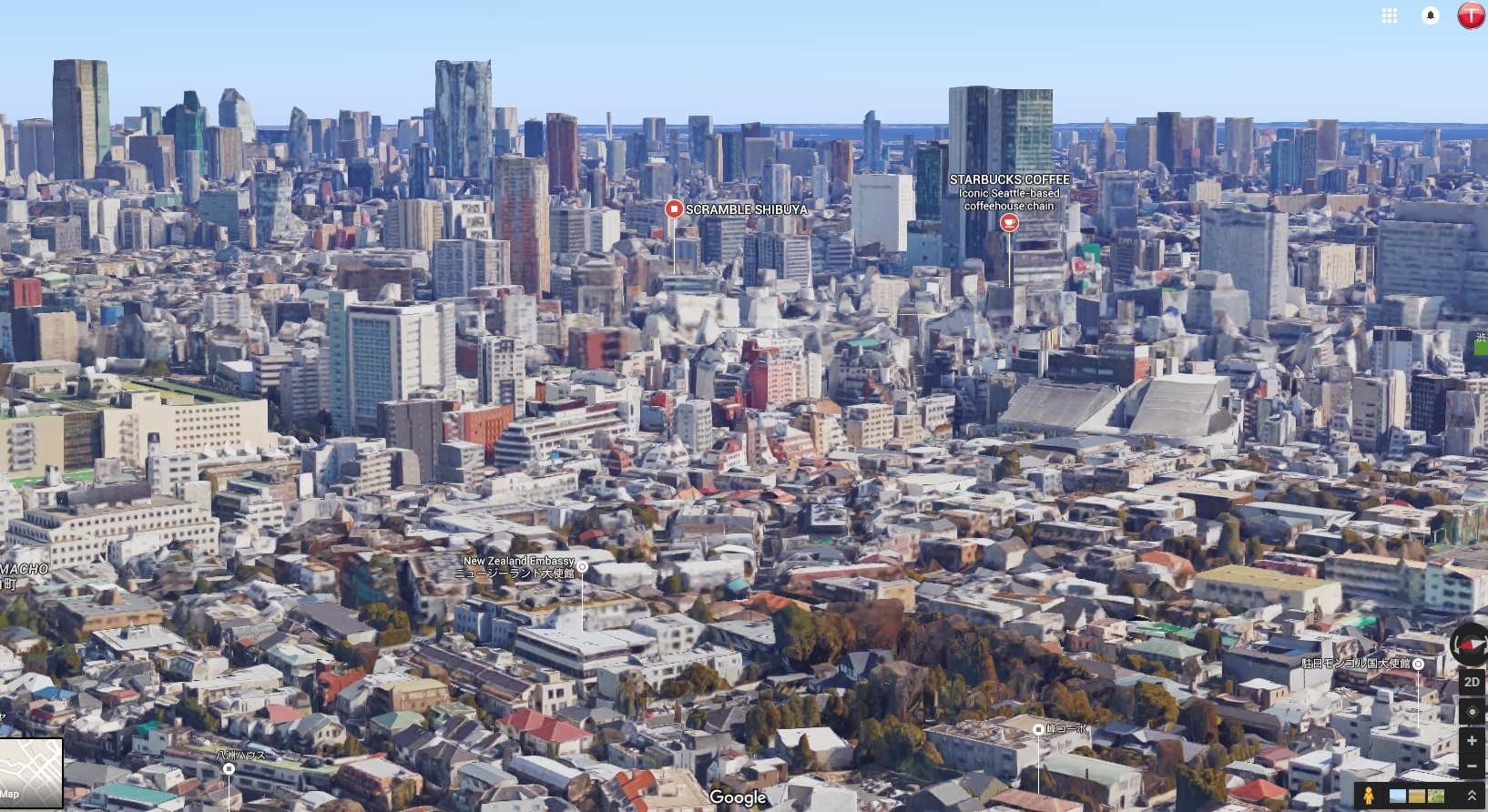
Google's 3D mode is impressive for it's scale, I'm not sure how they do it; I guess elevation data that's accurate enough for builds + merging street view images onto the 3d model.

Waze is the sat nav option of choice IMO.