
Let's have a look at this upcoming winter shall we and into 2024!
Some charts I've grabbed from netweather etc
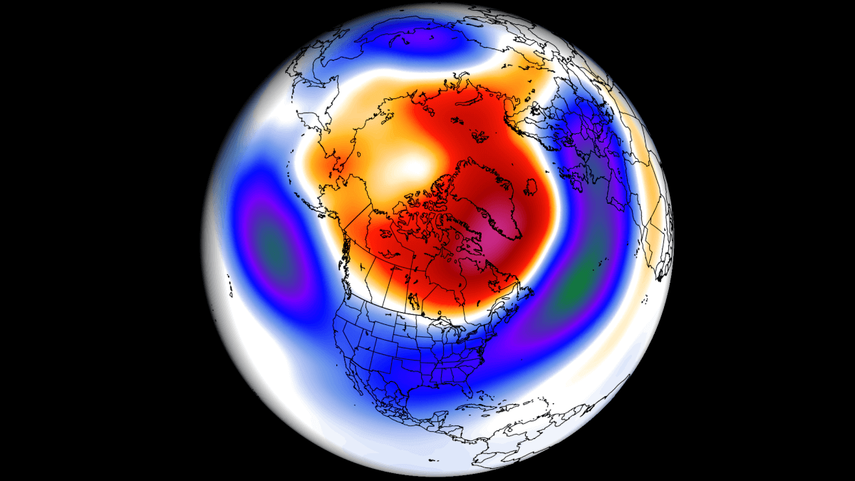
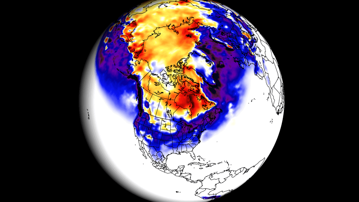
(High pressure looks to be rather dominant to our north/greenland)

Weather forecasts
 www.severe-weather.eu
- To early to tell what way the weather is going for this Winter, but already it's completely different than last year in terms of Summer into Autumn with the Jet Stream being a lot further south than normal.
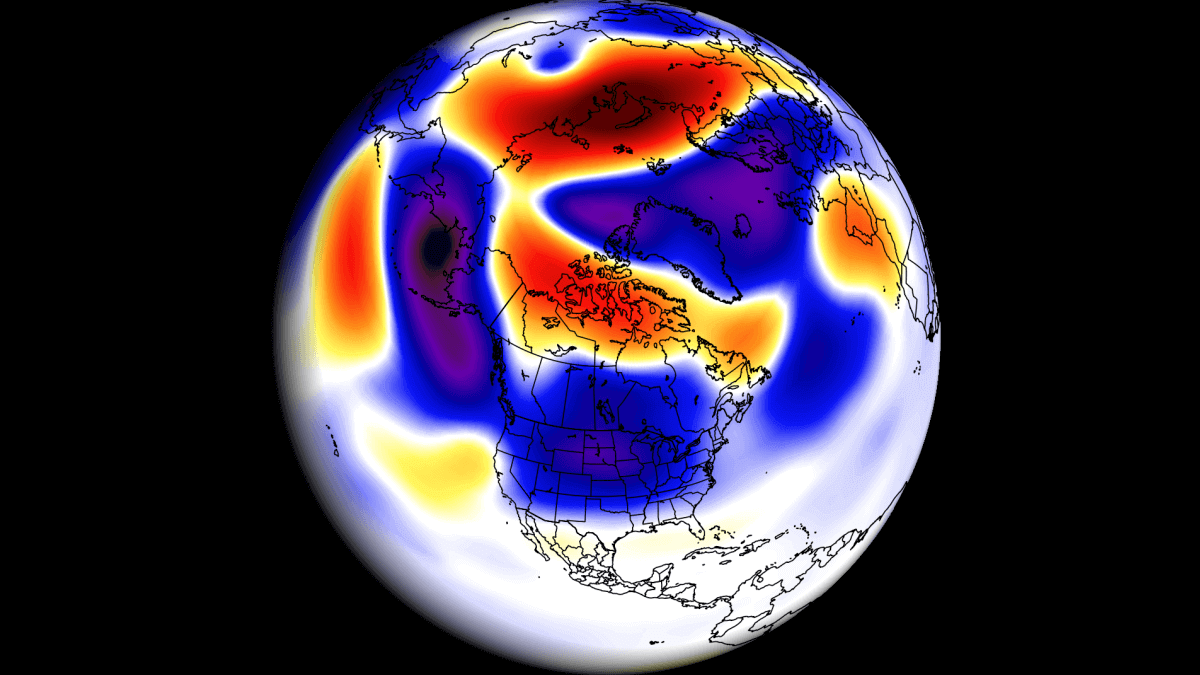
Some charts I've grabbed from netweather etc
(High pressure looks to be rather dominant to our north/greenland)
Weather forecasts
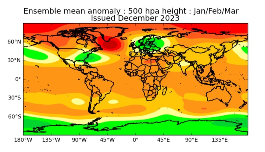
Europe is expected to have warmer-than-average temperatures over most of the western and central parts of the continent. Colder temperatures will be more defined in the northern and northeastern parts of the continent.
This means that the main circulation mode over Europe will be from north to south, meaning a northerly flow over Europe. The potential snowfall scenarios over central Europe will be bound to the intensity of the northerly flow and individual cold fronts coming down from the north.
The models are not in 100% agreement over the pattern in the North Atlantic. The main key is the positioning and strength of a potential high-pressure zone over Iceland/Greenland relative to the North American pattern.
Precipitation-wise, more precipitation is expected over central and southern Europe. The snowfall forecast shows less snowfall over Europe, despite more precipitation, except for the higher elevations.
Winter forecast 2023/2024: First in-depth Winter weather outlook and how the pressure patterns will develop under the strong El Nino event
A first look at the Winter 2023/2024 forecast for the United States, Canada, and Europe shows a strong influence of the growing El Nino event
www.severe-weather.eu
- To early to tell what way the weather is going for this Winter, but already it's completely different than last year in terms of Summer into Autumn with the Jet Stream being a lot further south than normal.


 !!!!
!!!!


")