

You are using an out of date browser. It may not display this or other websites correctly.
You should upgrade or use an alternative browser.
You should upgrade or use an alternative browser.
Winter 2023/24 - It's FREEZING!
- Thread starter Neil79
- Start date
- Status
- Not open for further replies.
More options
Thread starter's posts
2023 was UK's second warmest year on record (2022 was the warmest):
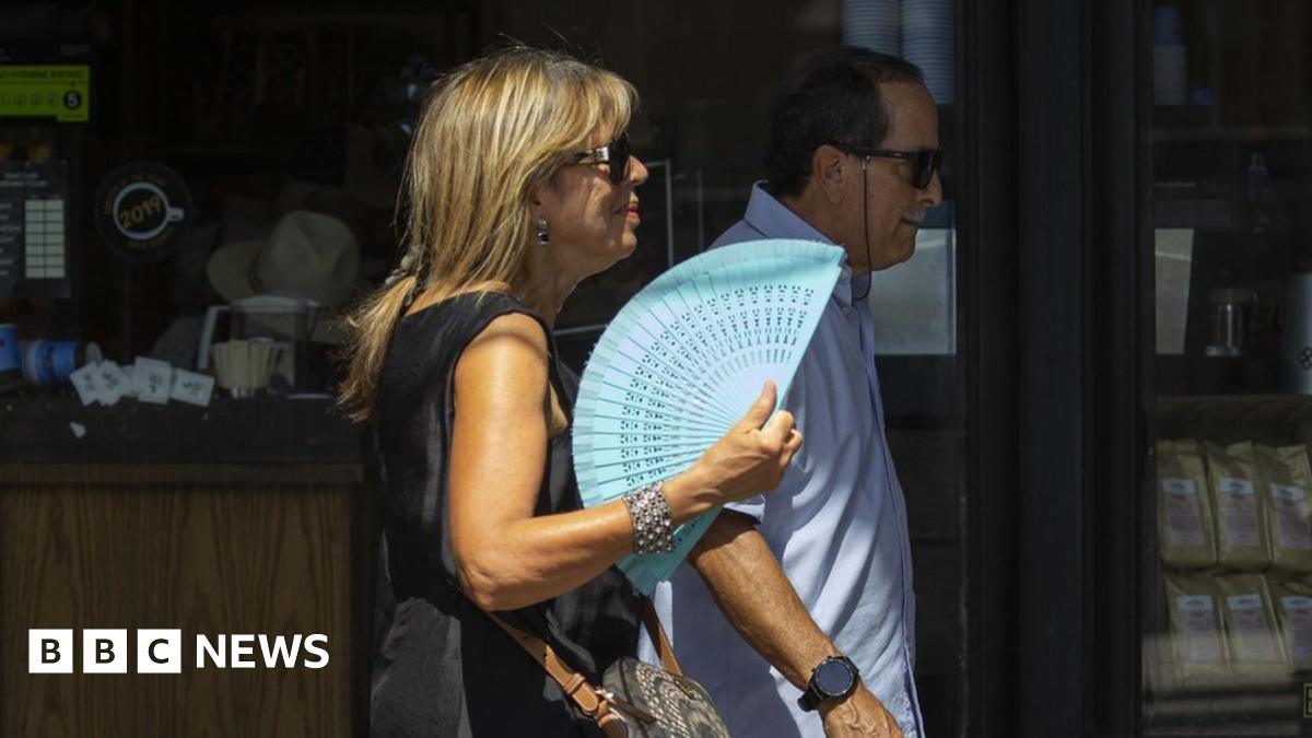
UK weather: 2023 was second warmest year on record, says Met Office
The 10 warmest years in the UK have all occurred since 2003 according to provisional Met Office data.
www.bbc.co.uk
Soldato
- Joined
- 10 May 2004
- Posts
- 12,971
- Location
- Sunny Stafford
2023 was UK's second warmest year on record (2022 was the warmest):
UK weather: 2023 was second warmest year on record, says Met Office
The 10 warmest years in the UK have all occurred since 2003 according to provisional Met Office data.www.bbc.co.uk
I saw that and was going to post in the "Summer 2023 - it's too hot!" thread but I can't find it. Anyway, I don't think that 2023 was the 2nd hottest summer despite the heatwaves in June and September. The bulk of the summer was wet and unseasonably cold and then the rest of the year seemed normal except that we don't really get snow any more.
I remember 1995, 2006, 2017 and 2018 all being hotter than 2023.
The average temperature though. Through the whole year almost it was exceptionally mild aside from a small number of brief cold snaps.
second half of January looks interesting, maybe getting some snow
Models are definitely interesting but hard to know what they are showing, typical patterns around exceptional SSW events in that the models go a bit nuts but that doesn't necessarily mean one thing or another :s only that someone somewhere will get some extreme weather one way or another :s
EDIT: Mid-month showing very cold air above us though.
Last edited:
The weather is crazy - whole building is vibrating over hereLast 10mims it's gone from quite calm here to very windy. Whole building is creaking with the big gusts
It's not just about peak heat in summer.I saw that and was going to post in the "Summer 2023 - it's too hot!" thread but I can't find it. Anyway, I don't think that 2023 was the 2nd hottest summer despite the heatwaves in June and September. The bulk of the summer was wet and unseasonably cold and then the rest of the year seemed normal except that we don't really get snow any more.
I remember 1995, 2006, 2017 and 2018 all being hotter than 2023.
Permabanned
- Joined
- 7 Aug 2017
- Posts
- 2,141
- Location
- by the tower the one up north ..
no it's about the cherry picking ...It's not just about peak heat in summer.


Soldato
- Joined
- 18 Jul 2021
- Posts
- 4,590
- Location
- Land of Gin (I wish)
There’s lots of flooding round here. We have some low lying roads which always get flooded
Monday 8 Jan - Wednesday 17 Jan
Next week will begin mostly dry with variable amounts of cloud and some sunny spells. The sunniest weather is likely to be in the north and west, although here some overnight fog patches are possible. Elsewhere, probably mostly cloudy with a cold easterly breeze developing in the south. By the middle of next week, the wind should ease and, with high pressure in charge, there should be a good deal of dry weather. Cloud amounts will continue to be quite variable, but all areas should see some sunshine at times. Much colder than recently, with frost probably becoming quite widespread and some freezing fog patches are possible in places. Beyond next week, conditions are likely to remain cold, with an increasing chance of some wintry showers, particularly in the north.
Thursday 18 Jan - Thursday 1 Feb
Compared to normal, there is an increased chance of colder than average conditions during this period. Currently the chance of widespread severe cold is still deemed low, but still the risk of impacts from cold, including ice and snow is greater than normal. It is likely to be drier than recent weeks, but what does fall is more likely to be of a wintry nature. While there is a chance of brief, unsettled spells, which would bring milder air for a time, it would likely also be accompanied by a period of sleet or snow. However, when, or even if, this would happen is very uncertain, and overall the main theme will be much more in the way of settled conditions through this period.
 www.metoffice.gov.uk
Next week will begin mostly dry with variable amounts of cloud and some sunny spells. The sunniest weather is likely to be in the north and west, although here some overnight fog patches are possible. Elsewhere, probably mostly cloudy with a cold easterly breeze developing in the south. By the middle of next week, the wind should ease and, with high pressure in charge, there should be a good deal of dry weather. Cloud amounts will continue to be quite variable, but all areas should see some sunshine at times. Much colder than recently, with frost probably becoming quite widespread and some freezing fog patches are possible in places. Beyond next week, conditions are likely to remain cold, with an increasing chance of some wintry showers, particularly in the north.
Thursday 18 Jan - Thursday 1 Feb
Compared to normal, there is an increased chance of colder than average conditions during this period. Currently the chance of widespread severe cold is still deemed low, but still the risk of impacts from cold, including ice and snow is greater than normal. It is likely to be drier than recent weeks, but what does fall is more likely to be of a wintry nature. While there is a chance of brief, unsettled spells, which would bring milder air for a time, it would likely also be accompanied by a period of sleet or snow. However, when, or even if, this would happen is very uncertain, and overall the main theme will be much more in the way of settled conditions through this period.
UK weather
Tromso-Langnes The latest UK weather forecast. Includes UK weather for today, tomorrow and long range forecasts up to 28 days.
www.metoffice.gov.uk
Man of Honour
- Joined
- 21 Nov 2004
- Posts
- 46,317
There’s lots of flooding round here. We have some low lying roads which always get flooded
Not going to be good when it rains again tomorrow.
Looks like the temps are going to stone dive this weekend! As from there, who knows!


Still 10 days out but the models have some consistency in them now, hinting at the possibility of proper cold and a snow event for many.
By Wed 10th the high should hopefully be into position over the north of the british isles and then push westwards towards Greenland which will allow an easterly flow to come in.
By Wed 10th the high should hopefully be into position over the north of the british isles and then push westwards towards Greenland which will allow an easterly flow to come in.
- Status
- Not open for further replies.