WORLD WEATHER THREAD

Monday evening doesn't look great..

Not seen this software before, zyGrib?

I assume it downloads data automatically and is not subscription based?

Also, does it cover the whole of the USA, the whole year round, i.e. during the spring storms seasons etc?

I looks like it has some interesting data on there that looks a little better presented than some of the tools I currently use, such as http://www.twisterdata.com/ .

Just found this too:

http://www.grib.us/Home.aspx

Do you know which is better, or whether it is an improved tool to those used by TwisterData.com?
 
Last edited:
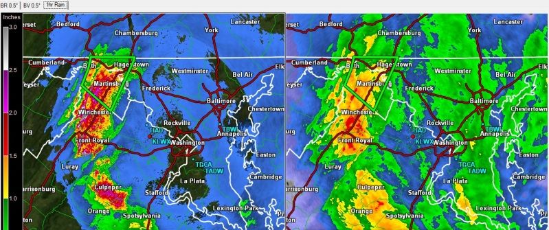
First flash flood warning in place for Martinsburg near Washington DC:

WAflood1.jpg


Some VERY heavy rainfall predictions, my software is showing a max rate of 6.3" for the next hour in parts.
 
701476mainairs20121029f.jpg

NASA's Atmospheric Infrared Sounder (AIRS) instrument on NASA's Aqua spacecraft captured this infrared image of Hurricane Sandy, another weather front to the west and cold air coming down from Canada at 2:17 p.m. EDT Oct. 29. The hurricane center is the darkest purple area in the Atlantic just to the east of the New Jersey coast, reflecting Sandy's areas of heaviest rainfall.

Image credit: NASA/JPL-Caltech
 
sandyvir2012303small720.jpg

The Visible Infrared Imaging Radiometer Suite (VIIRS) on the Suomi NPP satellite acquired this natural-color image of the storm at 1:35 p.m. Eastern Daylight Time (17:35 Universal Time) on October 29.
 
here comes the frost :D
-1.3°C already and dropping at 0.3°C an hour. :D
Hope the dirty derv starts in the morning :D
 
Back
Top Bottom