You are using an out of date browser. It may not display this or other websites correctly.
You should upgrade or use an alternative browser.
You should upgrade or use an alternative browser.
WORLD WEATHER THREAD
- Thread starter Neil79
- Start date
More options
Thread starter's postsA look at monsoons:
This visualization uses a combination of NASA satellite data and models to show how and why the monsoon develops over this region:
This visualization uses a combination of NASA satellite data and models to show how and why the monsoon develops over this region:
In the summer the land gets hotter, heating the atmosphere and pulling in cooler, moisture-laden air from the oceans. This causes pulses in heavy rainfall throughout the region. In the winter the land cools off and winds move towards the warmer ocean and suppressing rainfall on land.
The 360 degree one is pretty cool as well if a little low quality.
It does come across very well!
The most detailed and worldwide view of rain and snowfall ever created using satellite measurements from the Global Precipitation Measurement Core Observatory (GPM).
GPM is joint mission between NASA and the Japanese Aerospace Exploration Agency (JAXA).
More:
http://pmm.nasa.gov/GPM
GPM is joint mission between NASA and the Japanese Aerospace Exploration Agency (JAXA).
More:
http://pmm.nasa.gov/GPM
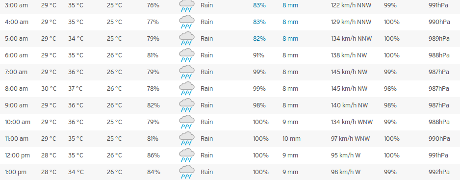
Haven't seen much in Western media of this yet, a lot of people seem to be in a "eh, first storm of the season" sort of mood, but this is bigger than the one (Soudelor) last year that was pretty horrible.


Stocked up on essentials (beer, pot noodles, water, fancy chicken wraps from costco), but not looking forward to tonight/tomorrow. Looks windy.
Stocked up on essentials (beer, pot noodles, water, fancy chicken wraps from costco), but not looking forward to tonight/tomorrow. Looks windy.
Greenland losing its ice. Between 2011 and 2014, Greenland lost around one trillion tonnes of ice. This corresponds to a 0.75 mm contribution to global sea-level rise each year. About twice the average of the preceding two decades.
NOAA's GOES-West satellite imagery from August 27 to 30 shows the movement of Category 4 Hurricane Madeline approaching Hawaii in the Central Pacific Ocean and Category 3 Hurricane Lester in the Eastern Pacific Ocean:
Timelapse video taken from the space station on August 30 shows Hurricanes Lester and Madeline in the Pacific Ocean, then Gaston in the Atlantic Ocean:
Timelapse video taken from the space station on August 30 shows Hurricanes Lester and Madeline in the Pacific Ocean, then Gaston in the Atlantic Ocean:
California checking in. Still hot, still dry, still a drought.
We'll send you some of our water. Had a years worth of rain in July, pretty much a thunderstorm every day. August we had more rain in the first week than the entire average month... Was great for my garden and new grass.

Tree leaves are starting to yellow now, as the nights are getting cold (6 degrees), but still 20+ in the daytime.

Tropical Storms and Hurricanes...
NOAA's GOES-East satellite imagery from August 29 to September 1 shows the movement of Tropical Storm Hermine in the Gulf of Mexico, Hurricane Gaston and fading Tropical Depression 8 in the Atlantic Ocean:
NOAA's GOES-West satellite imagery from August 29 to September 1 shows Tropical Storm Madeline as it moves past Hawaii and Hurricane Lester approaching the Hawaiian Islands:
Hurricane in Florida: http://www.bbc.co.uk/news/world-us-canada-37248359
What surprised me was that this is the first 'cane to hit the state in 11 years. Thought they had them all the time?
What surprised me was that this is the first 'cane to hit the state in 11 years. Thought they had them all the time?
Hurricane in Florida: http://www.bbc.co.uk/news/world-us-canada-37248359
What surprised me was that this is the first 'cane to hit the state in 11 years. Thought they had them all the time?
They do, they're just usually tropical storms by the time they hit land, or they skirt around the coast. Even this didn't get above a category 1 as far as I can see.

