

You are using an out of date browser. It may not display this or other websites correctly.
You should upgrade or use an alternative browser.
You should upgrade or use an alternative browser.
Road Cycling Essentials
- Thread starter Matutu
- Start date
- Status
- Not open for further replies.
More options
Thread starter's postsSuspended
- Joined
- 18 Oct 2002
- Posts
- 9,482
No.
The only team kits you should wear are teams you race/raced for yourself.
Nonsense. That only applies to National/World Champion jerseys and the GC, KOM & Sprinter's jerseys of GTs.
It's no different from a rugby supporter wearing their team's top.
So Ner!

Suspended
- Joined
- 18 Oct 2002
- Posts
- 9,482
It always makes me smile when you see a cyclist somewhere looking like a billboard advert
I have a lot of advertising space
")
I prefer the Jens Voigt method - "Shut up legs!"")
"There are times when your body is saying, 'I don't want to do this,' and your mind says, 'Shut up, body, and do what I tell you!'" Legendary
.Soldato
- Joined
- 10 Nov 2003
- Posts
- 14,033
- Location
- Surrey, by the river
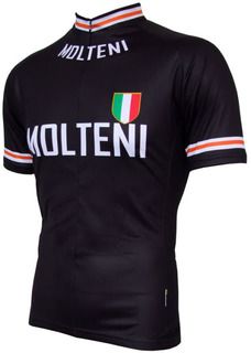
I usually wear a Molteni Jersey, which given they stopped racing the year I was born I can't really claim to have raced for them.
It is, however, very nice:
My favourite Jens Voigtisms:
1) 'I get paid to hurt people on my wheel; how cool is that?'
2) 'Having things organized is for small-minded people. Genius controls chaos'
3) 'Oh man, it’s going to take days to kill all these people'
It is, however, very nice:
My favourite Jens Voigtisms:
1) 'I get paid to hurt people on my wheel; how cool is that?'
2) 'Having things organized is for small-minded people. Genius controls chaos'
3) 'Oh man, it’s going to take days to kill all these people'
Soldato
- Joined
- 17 Oct 2002
- Posts
- 9,055
- Location
- In my penthouse, Park Ave
^^ Retro like that aren't so bad, I could just never see myself wanting to wear something like that Liquigas.
Soldato
- Joined
- 10 Nov 2003
- Posts
- 14,033
- Location
- Surrey, by the river
Was riding that sportive at the weekend when a chap just started talking to me about when he met Eddy Merckx (who rode for Molteni). Had a nice chat.
Soldato
- Joined
- 17 Oct 2002
- Posts
- 9,055
- Location
- In my penthouse, Park Ave
I think I posted this before:
6thElement said:"A Sunday in Hell is a truly wonderful documentary following Eddy Merckx and other stars of the day on their quest to win the 1976 Paris Roubaix. A true classic if ever their were a classic sports film."
Then you can watch the 1974 Giro
Suspended
- Joined
- 18 Oct 2002
- Posts
- 9,482
^^ Retro like that aren't so bad, I could just never see myself wanting to wear something like that Liquigas.
Why? Colours? Design? I really like it, but taste is subjective obviously.
I have an 2010 Astana kit and it defo makes me ride quicker
Suspended
- Joined
- 18 Oct 2002
- Posts
- 9,482
I have an 2010 Astana kit and it defo makes me ride quicker
Can you dance on the pedals like Alberto?
Please do post a kit list, will be very useful when I start packing for the summer tours!
Here's this years kit list
http://fwd4.me/00uR
I've not changed it all from last year. When we tour in the Autumn months in Scotland then we add a microfleece and a second pair of long fingered gloves but thats about it.
Here's this years kit list
http://fwd4.me/00uR
I've not changed it all from last year. When we tour in the Autumn months in Scotland then we add a microfleece and a second pair of long fingered gloves but thats about it.
I like that, nice and light. A few questions, if you don't mind:
Shorts, shirts, socks - did you wash these or anything on the tour, or were they fine to wear multiple days on the trot? I'd love to keep it to 2 lots of each like you've done, and then presumably swap them around each day?
Waterproofs and arm/leg warmers - would you take these even in the summer?
Electricians tape - is this basically duct tape?
How did you find the Sustran's maps? I have a Garmin now, so I was planning on taking a road atlas or something as a backup because individual maps seem to be a bit expensive. I could always just photocopy the pages that I need rather than taking the whole thing though...
Two sets of cycling clothes, wear a set on one day. Shower and wash that days clothes when you get to the B&B in evening. Leave to dry whilst you grab a pint and some food. Use the spare dry set the following day. This means that if your first set do not quite dry in time then you can finish drying them on the second evening and still have dry clothes for the 2nd days ride. Nothing fancy, bar of soap and shower - stay low tech. The soap gets used for body, hair and clothes - just like it was in the 50s and 60s, though I do treat myself to Dove moisturising soap
Waterproofs and warmers - yup even in summer. It depends on where your touring but a little bit of rain and some height, such as on the moors, and cycling can be very unpleasant. The only time I havent taken leg warmers was touring the Scottish borders in late September/October. It was cold enough to take a microfleece hiking jumper and long leggings and wear them every day.
Electricians tape - not quite duct tape, just electrically insulating black tape. Some folks take a bit of duct tape, tear lengths off and stick them on the inside of your panniers for when you need to make running repairs (re: bodge).
Sustrans maps - only used if were using a Sustrans route. Never used during the day, just used in the evening to read up on the next days exploits. When we haven't been following Sustrans routes we just print the appriopriate OS maps out on a works laser printer then laminate them (along with instructions on where we stay in the evening). I'll upload this years route document out so you can see what I mean.
I've never really got on with the Garmin 705 mapping. I've been privileged enough to own a SatMap device and the complete UK 1:50k OS maps which is a remarkably effective combination for both distance cycling and hiking.
Here is the route card that we print and laminate:
http://www.malia.info/stuff/misc/cycle.tour.2011-01.pdf
You can usually add between 5 and 15% to the expected daily distance and the estimated ascent is normally miles off. Mapping on a software package always seems to significantly underestimate the totals. For instance, this years day 1, we plan to do 81 miles, but I wouldn't be surprised if it's closer to 90.
Last edited:
snip
Cheers for the reply.
I like the look of those route cards, might do something similar myself. Having a graph to show the altitude changes looks quite useful too, so you can plan rest breaks and stuff before a big climb.
I'll probably pop back in here to ask a few more questions closer to the tour itself, but good luck with yours!
Associate
- Joined
- 27 Apr 2004
- Posts
- 2,377
It's my first day off from revision/dissertating tomorrow, and it's just dawned on me that, lower back pain aside, my range is very likely to be limited by the fact I can only carry 1.6L of drink with me. 
- Status
- Not open for further replies.